Views: 0 Author: Site Editor Publish Time: 2026-06-10 Origin: Site
Investing in a fleet management or asset tracking system requires complete trust in the data it generates. However, real-world GPS inherently carries physical limitations, leaving buyers hesitant to fully commit. Marketing brochures often promote theoretical GPS accuracy. Yet, operational precision—what you actually observe on your dashboard map—can vary wildly. You must look past spec sheets to understand how environmental factors and signal delays impact true location mapping.
A modern Vehicle Tracking Device proves highly accurate under optimal conditions. Navigating this market requires understanding hardware quality, network constraints, and how refresh rates shape your specific business outcomes. This guide breaks down exactly what accuracy means, what degrades it, and how to test a system in the real world.
Standard commercial tracking devices achieve 2.5 to 3-meter accuracy under clear skies.
"Accuracy" in telematics is a combination of location precision (GPS satellite connection) and data recency (cellular network ping rates).
Environmental factors—such as urban canyons, heavy foliage, and improper installation—are the primary causes of location drift.
High-frequency updates (e.g., 1-second pings) are essential for real-time dispatching but unnecessary for basic mileage logging or theft recovery.
Evaluating a solution requires testing multi-constellation tracking capabilities and software-side interpolation during a live pilot.
Understanding telematics requires separating theoretical claims from practical reality. Manufacturers usually build hardware around standard GNSS (Global Navigation Satellite System) modules. These receivers calculate position by triangulating signals from orbiting satellites. Under a clear sky, a standard commercial unit sets a baseline expectation of approximately 3 meters (about 10 feet) of precision. This radius means the software knows the vehicle sits within a specific traffic lane or parking spot.
However, we must differentiate between two distinct concepts: location accuracy and temporal accuracy. Location accuracy relies purely on the hardware's satellite fix. It determines exactly where the vehicle sits at a specific millisecond. Temporal accuracy relies on transmission intervals, often called ping rates. This defines how frequently the hardware updates the software map over a cellular network. A highly precise satellite fix feels useless if the map only refreshes every ten minutes during a high-speed pursuit.
To improve baseline reliability, developers integrate multi-constellation support. Modern enterprise trackers do not rely on the American GPS network alone. They connect simultaneously to GLONASS (Russia), Galileo (Europe), and sometimes BeiDou (China). Accessing multiple satellite networks drastically reduces cold-start times. When a driver turns the ignition early in the morning, the tracker locks onto a position much faster. Multi-constellation tracking ensures the device rarely struggles to find a reliable signal baseline.
Accuracy Type | Primary Driver | Impact on End-User Experience |
|---|---|---|
Location Precision | GNSS Chipset & Satellites | Determines the exact coordinate pinpoint on the map interface. |
Temporal Precision | Cellular Modem & Ping Rate | Determines how smoothly the vehicle icon moves along the route. |
Even the most advanced hardware cannot defy physics. Environmental factors frequently interrupt line-of-sight connections between the sky and the receiver. Recognizing these limitations helps managers set realistic expectations for their dispatching teams.
The "urban canyon" effect creates the most common disruption. High-rise buildings in dense city centers block direct satellite signals. Instead of reaching the antenna directly, signals bounce off glass and concrete facades. This bouncing causes signal multipath errors. The receiver calculates the time delay of the bounced signal, which makes the vehicle appear blocks away on the map. You will often see temporary mapping inaccuracies, like a vehicle seemingly driving through a skyscraper.
Hardware installation placement heavily dictates overall performance. Implementation realities often clash with ideal engineering environments. Fleet managers typically want trackers hidden from drivers or thieves. Consequently, installers place units deep inside an engine bay or under dense metal dashboards. Dense metal acts as a shield. It severely disrupts the antenna line-of-sight. Proper installation requires placing the antenna facing upward, just under the dashboard plastic or windshield glass.
Finally, consider cellular network blind spots. A Vehicle Tracking Device might know its exact location via satellite, but it cannot transmit that data without cellular coverage. Driving through remote rural routes or mountainous terrain severs the data pipeline. The software map will freeze. To mitigate this, enterprise devices use standard "Store and Forward" capabilities. The hardware caches hundreds of location pings in its internal memory. Once the vehicle re-enters a cellular coverage zone, the device uploads the entire chronological backlog to the software.
Urban Canyons: Dense skyscrapers cause signal multipath errors, making vehicles jump across the map.
Heavy Foliage: Dense tree canopies, especially when wet, absorb satellite radio frequencies.
Improper Placement: Mounting units beneath heavy steel engine components restricts satellite visibility.
Network Blind Spots: Loss of 4G/LTE coverage pauses map updates, triggering store-and-forward caching.
Buyers often wonder why enterprise hardware commands a premium over consumer-grade online alternatives. The answer lies in the form factor, internal sensor arrays, and the backend software architecture.
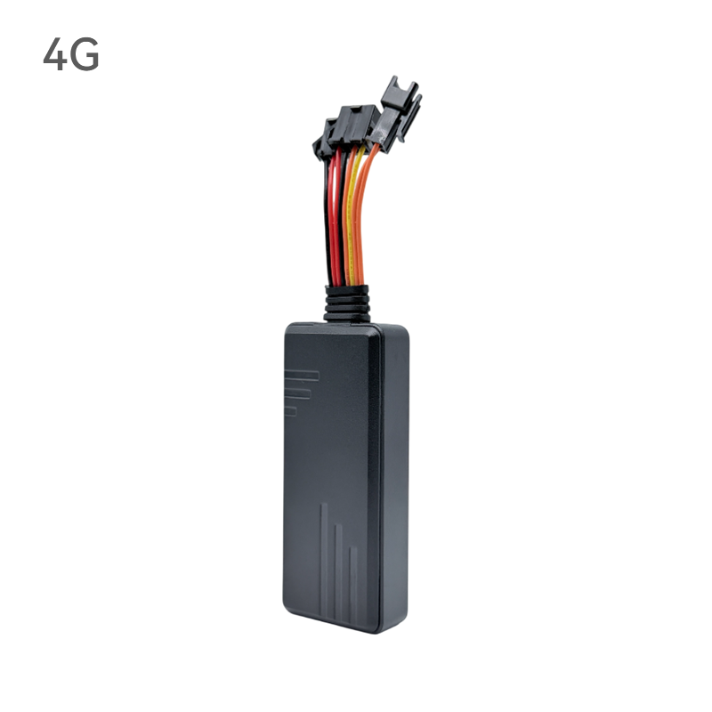
Form factor directly impacts mapping accuracy. You generally choose between plug-and-play (OBD-II), hardwired, and battery-powered discrete trackers. The primary differentiator here is power availability. Constant power dictates the permissible ping rate. Hardwired and OBD-II trackers draw endless power directly from the vehicle battery. They can afford to transmit location data every single second. Conversely, discrete battery-powered trackers must conserve energy. They often sleep, waking up only once a day to send a single ping. Therefore, perceived accuracy drops significantly with battery-powered units.
Premium commercial units counteract environmental limitations using dead reckoning technology. Dead reckoning incorporates inertial navigation systems directly into the hardware board. These systems feature highly sensitive accelerometers and gyroscopes. When a delivery truck enters a long underground tunnel, satellite signals vanish completely. The gyroscope detects directional turns, while the accelerometer calculates speed changes. The processor combines this sensor data to estimate the truck's exact position within the tunnel. Once it exits, the satellite connection resumes seamlessly.
Software interpolation serves as the final layer of precision. Even excellent hardware occasionally drifts a few feet off course. Enterprise fleet management software uses "snap-to-road" algorithms to correct these minor GPS drifts. The software analyzes the erratic breadcrumb trail and snaps the data points to the nearest logical street vector. This creates a clean, readable historical trip log rather than a jagged line crossing through residential lawns.
Best Practice: Always choose hardwired installations for heavy commercial trucks. They prevent driver tampering while delivering the highest temporal accuracy through constant power.
Chasing absolute millimeter perfection often wastes resources. You must align the hardware capabilities with your actual operational demands. Different industries require vastly different combinations of temporal and location accuracy.
High-Frequency Routing & Dispatching (1 to 10-second pings): Rapid updates remain non-negotiable for emergency medical services, police, and last-mile delivery fleets. Dispatchers need to see vehicles moving fluidly in real time. Missing a highway exit or taking a wrong turn creates immediate operational friction. Taxi fleets also rely on tight pings to assign the genuinely closest driver to a waiting passenger. High-frequency updates demand robust hardwired devices and generous cellular data plans.
Compliance, Mileage & Fleet Maintenance (1 to 3-minute pings): Many businesses merely need to track where their service vans traveled yesterday. Lower temporal accuracy proves perfectly adequate for these scenarios. If your goal centers around ELD (Electronic Logging Device) compliance, tax logging, or preventative maintenance scheduling, a 2-minute ping rate works flawlessly. The software still calculates total mileage accurately. It also drastically reduces cellular data loads, proving much more cost-effective for large national fleets.
Asset Recovery & Anti-Theft (On-demand or low-frequency): Tracking stolen trailers or construction equipment requires a different strategy. Pinpoint second-by-second accuracy matters less than stealth and longevity. Thieves scan for constant cellular signals. A discrete Vehicle Tracking Device sleeping quietly inside a bulldozer chassis remains undetected. It only wakes up once every 12 hours. If the equipment goes missing, managers can trigger an aggressive recovery mode, shifting to 30-second pings until police secure the asset. Here, robust cellular fallback and multi-year battery life take precedence.
Never deploy hundreds of devices based solely on a sales presentation. Proper due diligence requires a structured evaluation framework. Testing hardware in your specific operational environment reveals its true accuracy limits.
First, establish a credible pilot program structure. Request a 30-day proof of concept (PoC) from your short-listed vendors. Install the units across 3 to 5 vehicles that encounter varied environments. Send one truck through dense urban downtowns to test multipath errors. Send another through rural, tree-covered routes to test cellular store-and-forward limits. Review the map data weekly. Look for jagged lines, delayed pings, or missing trip segments.
Next, perform a rigorous hardware inspection. Do not just accept generic specification sheets. Verify the exact multi-constellation GNSS support. Ask the vendor about the specific cellular modems inside the casing. Modern units should utilize LTE Cat-M1 or NB-IoT modems. These low-power wide-area network protocols penetrate buildings and parking garages much better than legacy 3G networks. They ensure data transmits reliably even in weak signal areas.
Finally, conduct an SLA and support assessment. Hardware breaks, and networks experience outages. Review vendor uptime guarantees thoroughly. Look into their data retention policies. Ask them directly for transparent documentation regarding their hardware failure rates. A reputable vendor openly shares their defect percentage. A system's true reliability encompasses not just tracking precision, but how quickly the provider replaces a failing unit in the field.
Common Mistake: Rushing a pilot program in just a few days usually fails to capture edge cases. Weather changes, differing driver routes, and weekend parking scenarios require a full month to evaluate properly.
A modern vehicle tracking device provides robust, reliable accuracy designed for demanding environments. However, total system reliability depends heavily on your choices. Proper hardware selection, strategic installation placement, and understanding your network environment ultimately define the results you see on the screen.
When selecting a solution, stop chasing the illusion of absolute perfection. Instead, focus on matching the hardware's ping rate and connectivity specifications to your operational needs. A long-haul trucking company needs different specifications than a downtown ambulance service. Evaluate your requirements honestly.
Do not leave your fleet visibility to chance. Request a hardware pilot to test these concepts in your actual vehicles. Consult directly with a telematics engineer to assess your unique deployment environment and secure the precise tracking your business demands.
A: Yes, but with limitations. Underground structures block satellite line-of-sight entirely. Standard devices will report their last-known location at the tunnel entrance. Premium commercial devices bypass this issue using dead reckoning sensors (accelerometers and gyroscopes) to calculate ongoing movement internally until they regain sky visibility.
A: This visual glitch results from GPS drift or multipath errors. Tall buildings or heavy weather can slightly scatter satellite signals, causing the coordinate to jump a few meters. Most enterprise software fixes this using "snap-to-road" algorithms, which pull erratic data points back onto the mapped street vector automatically.
A: Standard weather like rain or cloud cover has minimal impact on modern GNSS receivers. However, severe atmospheric conditions, solar flares, or heavy physical obstructions like a wet, dense tree canopy can temporarily absorb radio frequencies and reduce immediate mapping precision.
A: The core GPS receivers operate similarly, but hardwired units appear much more accurate on a live map. Hardwired devices rely on unlimited vehicle power, allowing continuous, high-frequency data transmission (e.g., 1-second pings). Battery-powered units must sleep to conserve energy, resulting in delayed temporal accuracy.